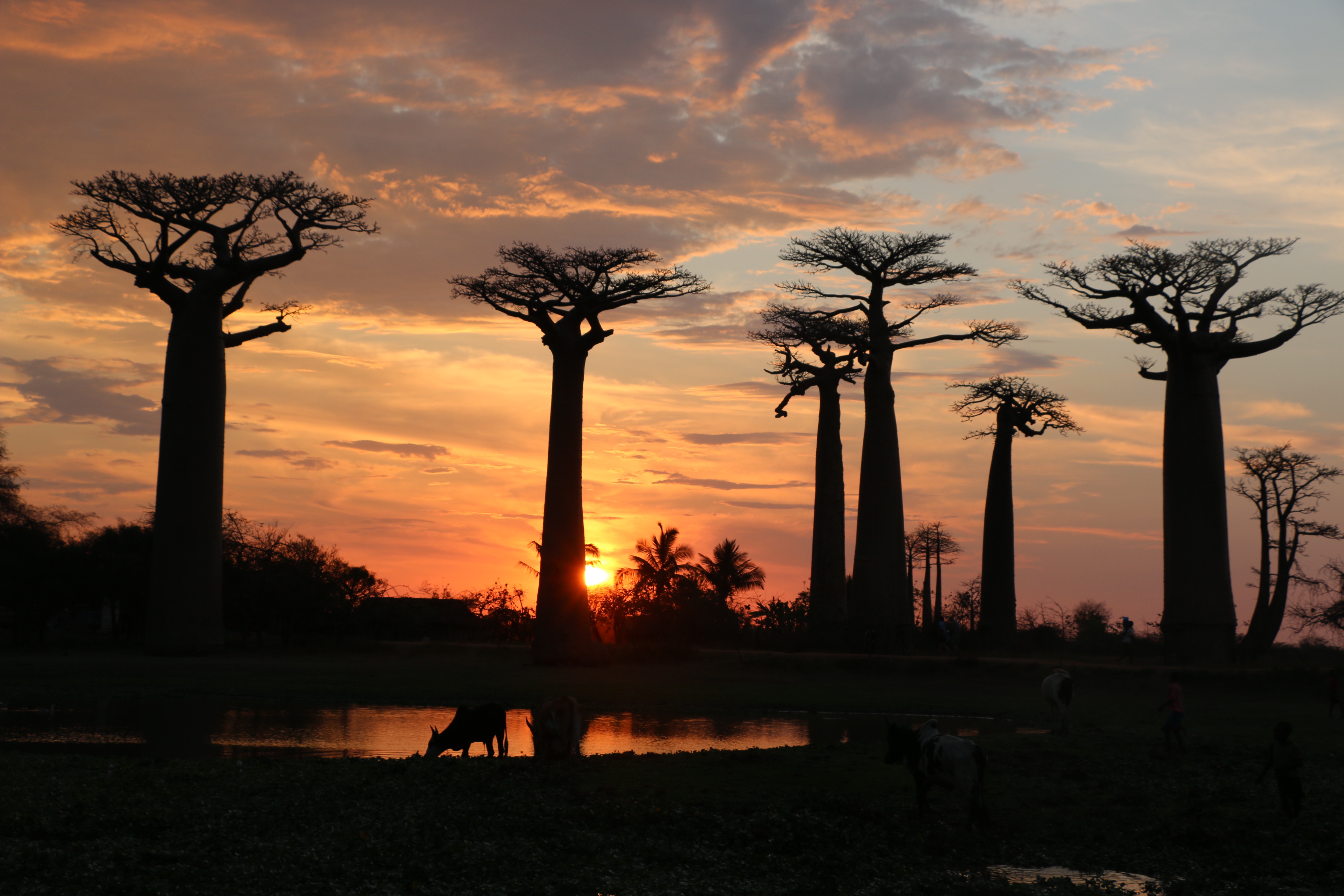
Madagascar
Surviving the Tsingy: Exploring Tsingy de Bemaraha

After trekking for Gorilla’s for 8 hours in Uganda, I was under the impression that I had completed and conquered the biggest physical challenge of my African Adventure… I didn’t realise I would make it to western Madagascar to rock climb the spectacular mineral forest – Tsingy de Bemaraha.
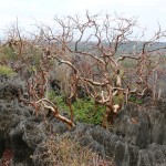
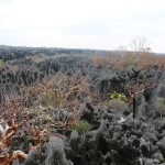
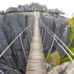
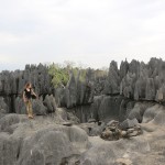
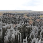
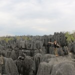
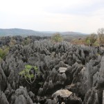
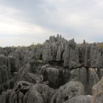
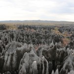
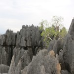
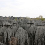
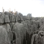
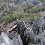
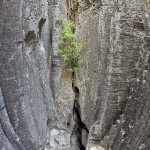
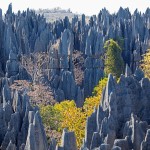
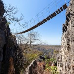
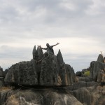
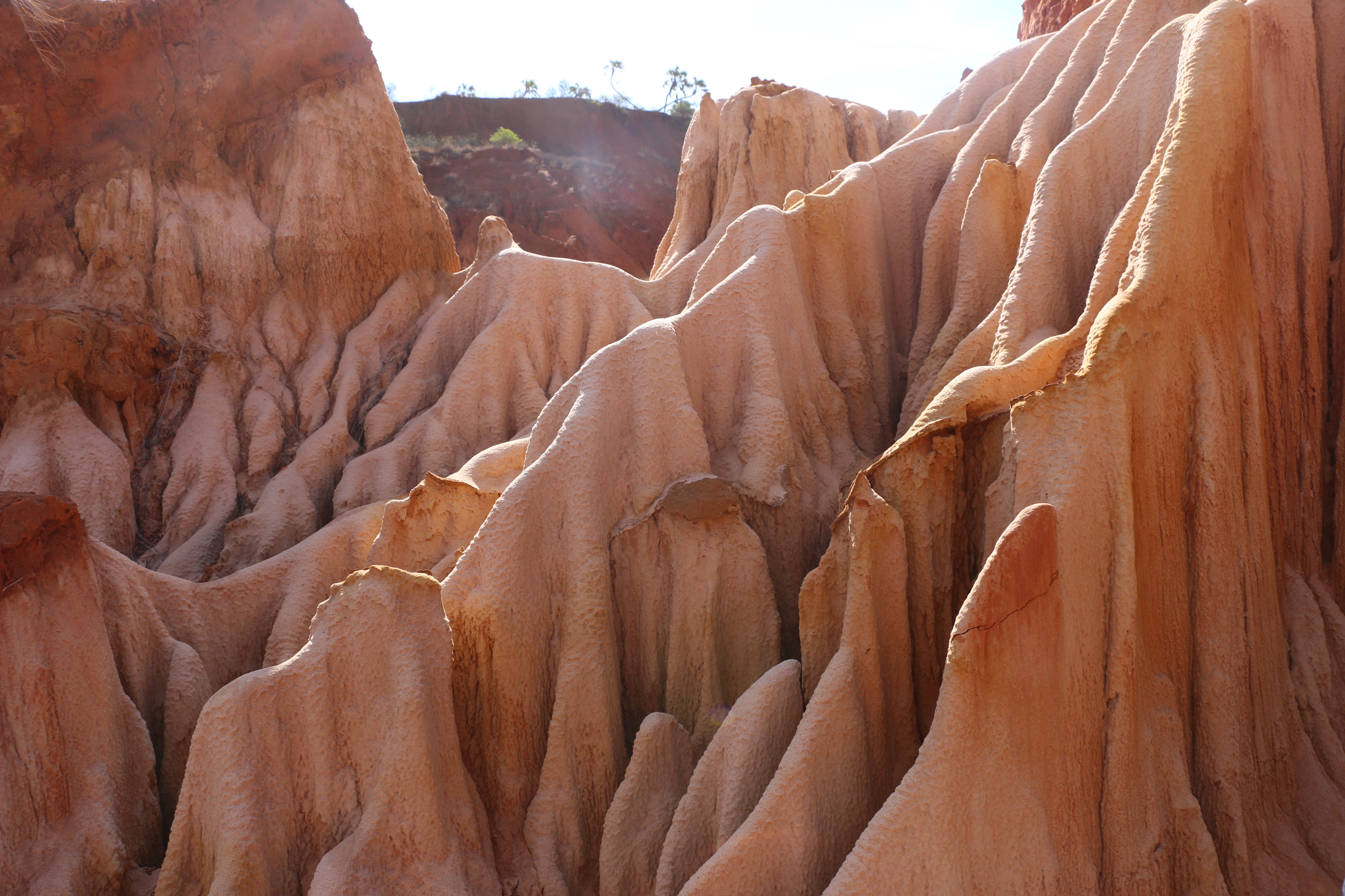
 Razor-sharp rocks, tiny precarious rock bridges and 300ft drops – the otherworldy terrain of Tsingy de Bemaraha on the western side of Madagascar is not for those afraid of heights. The needle-like landscape’s name literally translates as ‘where one cannot walk barefoot’ and the nearly impenetrable labyrinth of limestone needles justifies this name. But even with shoes, it can prove a challenge for hardy explorers…
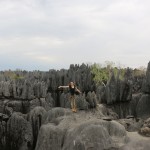
I am no hardy explorer but I was convinced to challenge myself to the parks longest, and most challenging trek/rock climb/caving experience. It was honestly the most challenging day of my life.
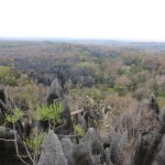
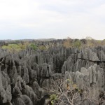
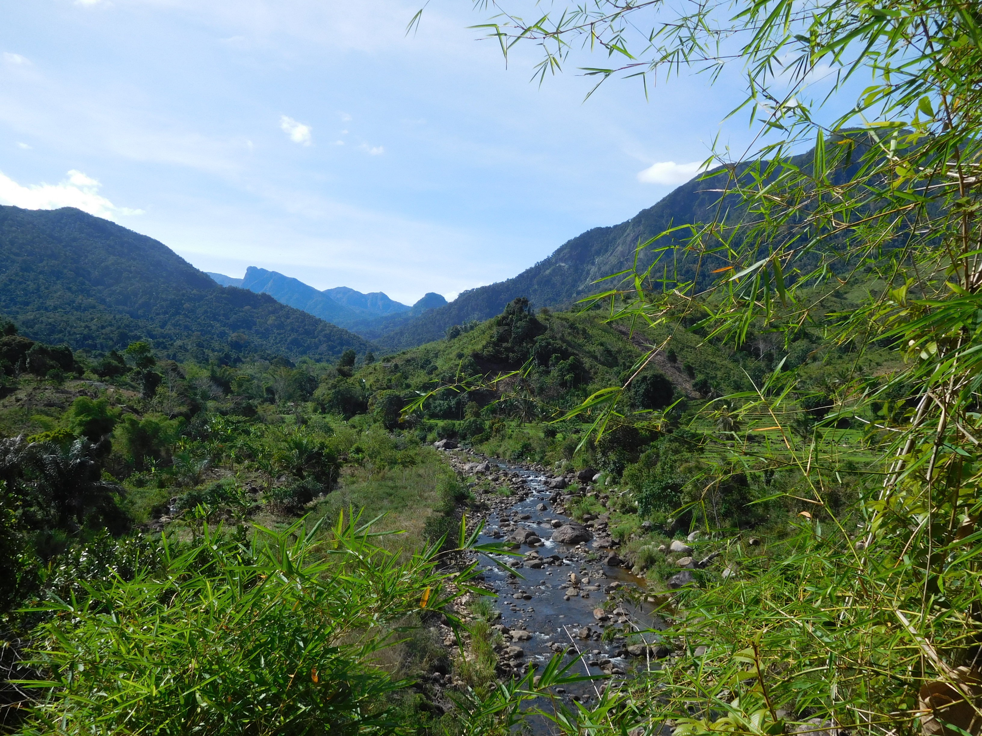
The whole protected area, designated a World Heritage Site by the UNESCO in 1990, comprises a surface of 1.575 km². This remote area was not a tourist trek until 1998, when the southern part (723 km²) was declared a National Park. Monsoon rains, wind and floods are responsible for the carving of the jagged crags over time, with caves and canyons forming below the rocky surface.
For those who want a more elaborate explanation of the magnificent region, here is some great information from Travel Madagascar…
The limestone seabed rose to create a plateau around 200 million years ago, which was little by little eroded by heavy rainfalls until it became its actual shape. This massif is delimited to the east by the abrupt Bemaraha Cliffs, which rises some 300 to 400m above the Manambolo River valley and extends several tens of kilometres from north to south. The western slopes of the massif rise more gently, and the whole
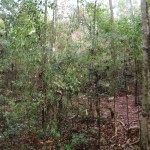
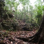
western region of the reserve forms a plateau with rounded hillocks which slope away to the west. To the north undulating hills alternate with limestone extrusions, while in the south extensive pinnacle formations make access extremely restricted. In the south of Petit Tsingy is the spectacular Manambolo Gorge where you can see waterfalls, lemurs and magnificent untouched forests. Despite the inaccessibility of the area, this park is more and more part of tour operator programs.
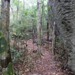
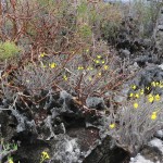
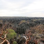
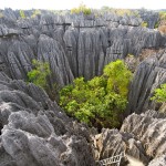
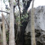
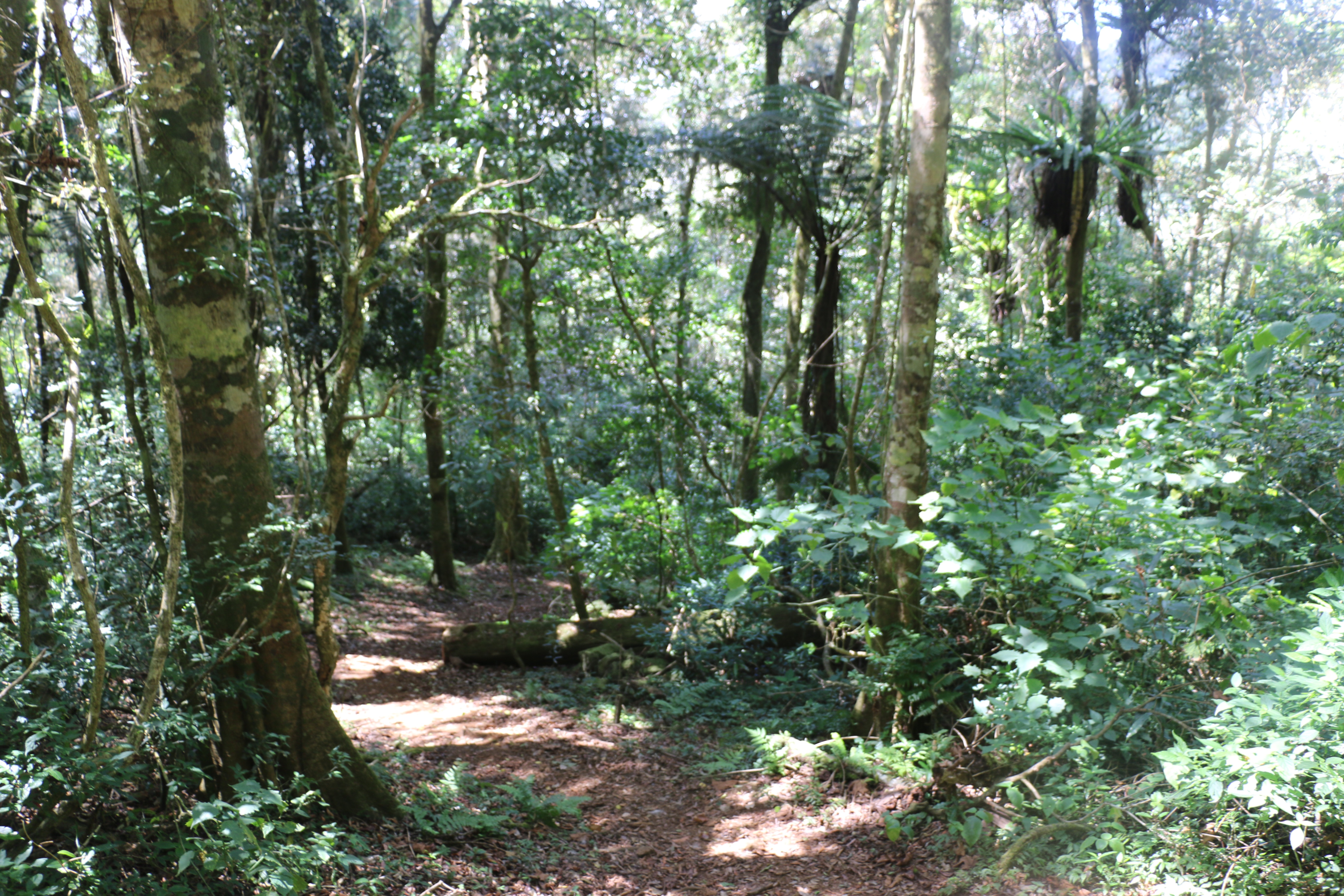
The flora has a high local endemism rate. The western part is principally covered by deciduous dry forests, which are particularly well adapted to the extreme changing climate conditions of the area. The eastern section is formed by grassy savannas and lowland bushes. Inside the canyons we find small areas of dense tropical forests and lianas, since it is very humid among the tall tsingy formations.
Visitors can spot 11 lemur species, including for Decken’s sifaka, red-fronted brown lemur, fat-tailed dwarf lemur, grey mouse lemur or the Cleese’s woolly lemur and the Sambirano lesser bamboo lemur, which only occur here. Other resident mammals are the small carnivorous falanouc and ring-tailed mongoose, and several bats.
More than 100 bird species have been catalogued at present inside the National Park, including the critically endangered Madagascar fish eagle and crested ibis, Madagascar wood-rail, giant coua or Coquerel´s coua.
The 45 reptiles and amphibians which are found here are all endemic. Some significant species which only occur in Bemaraha are the Madagascar iguana, a local endemic long-tailed skink and the Antsingy leaf chameleon.

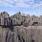
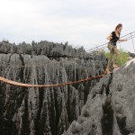
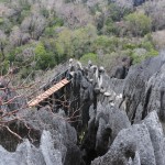
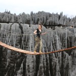
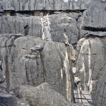
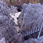
This national park is undebatably one of Madagascar’s wonders and has been recognised as a UNESCO World Heritage Site for good reason. But admiring this wonder takes great effort – and courage. Ropes and climbing equipment are needed for navigating across the larger pinnacles, with the highest towering several hundred feet in the air. Walkways have been constructed to allow visitors to see this place in ‘safety’. As in ‘Madagascan-rated safety’. Apparently no one has died yet but the challenging circuits are nothing short of terrifying and everyone must have just been extremely careful so far…
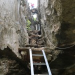
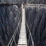
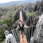
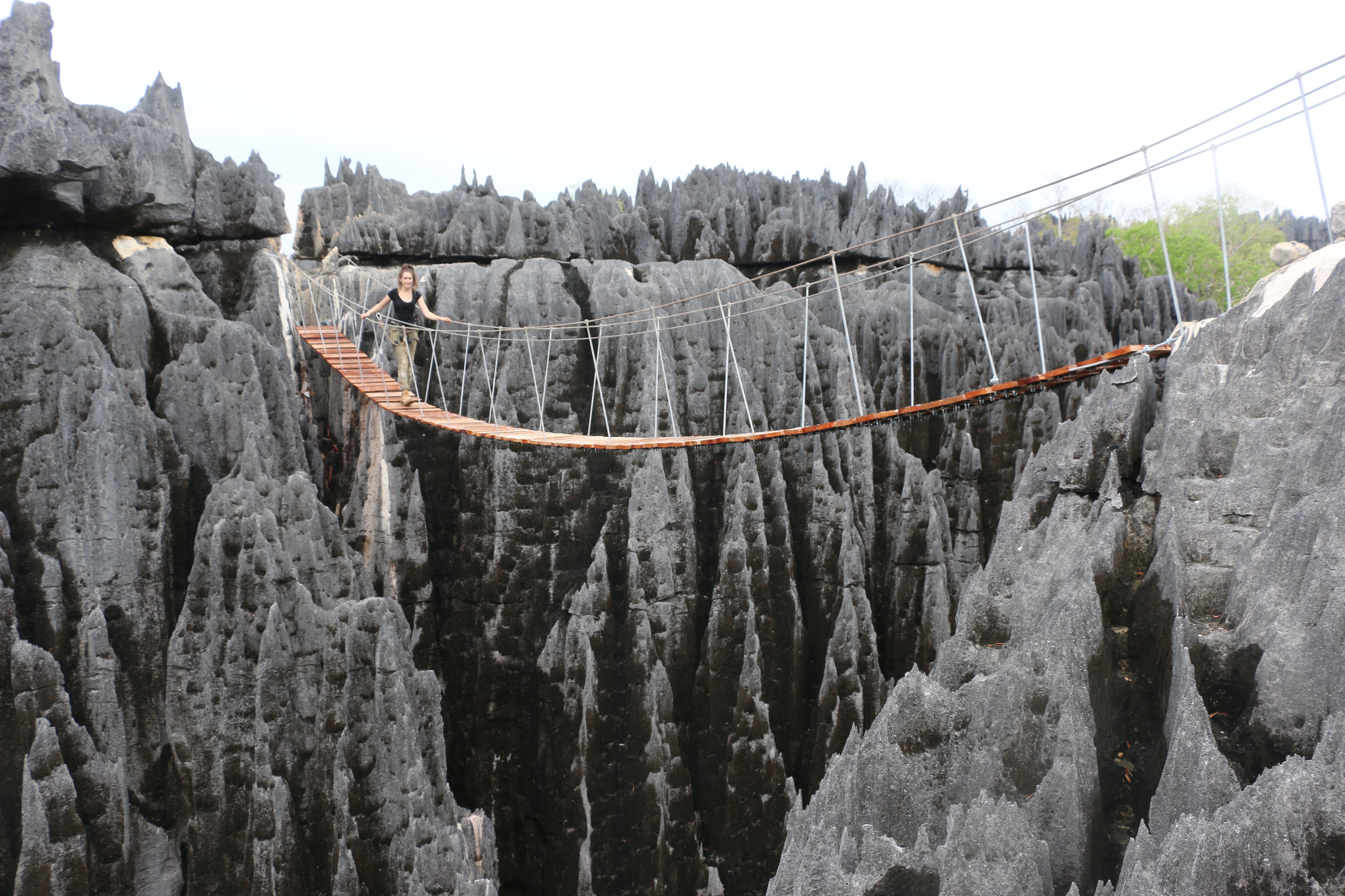
 The ‘hike’ itself involves some challenging cliff and rock climbing, crawling through some tight caves, steep high ladders, swinging suspension bridges between broad canyons…
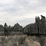
As I mentioned before, I went for the full-day, ‘up-for-a-challenge’, ‘you’re-young-you’ll-be-fine’ circuit… Also known as the ‘Broadway’ through the Grand Tsingy. I am writing this 3 days later and my legs still feel like jelly…
To complete this circuit cannot have a fear of heights (or scary caves) or at least be able to ‘allow the beauty to conquer the fear’…
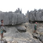
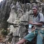
You are fitted with safety harnesses and some of the super-scary climbs offer karabiners, but my guide didn’t seem to think they were necessary or enforce any form of safety… (He did however sing a lot of Rihanna hits).
Honestly this climb was the most challenging thing I have ever done – especially due to some wet weather conditions. But hey, I finished the 7-hour journey in 5… Probably not due to great fitness, just a desperation to be on flat ground…
 For those looking for an easier route, narrow walkways and bridges allow visitors to view the stunning, natural limestone landscape from above.
A day exploring the Tsingy is not for the faint-hearted but cannot be missed if you have the time to travel to Western Madagascar.
When To Go: Access is impossible during the rainy season so the best idea is to visit during April/May or November/December for the best weather (I can’t imagine how much harder the hike would have been in the heat).
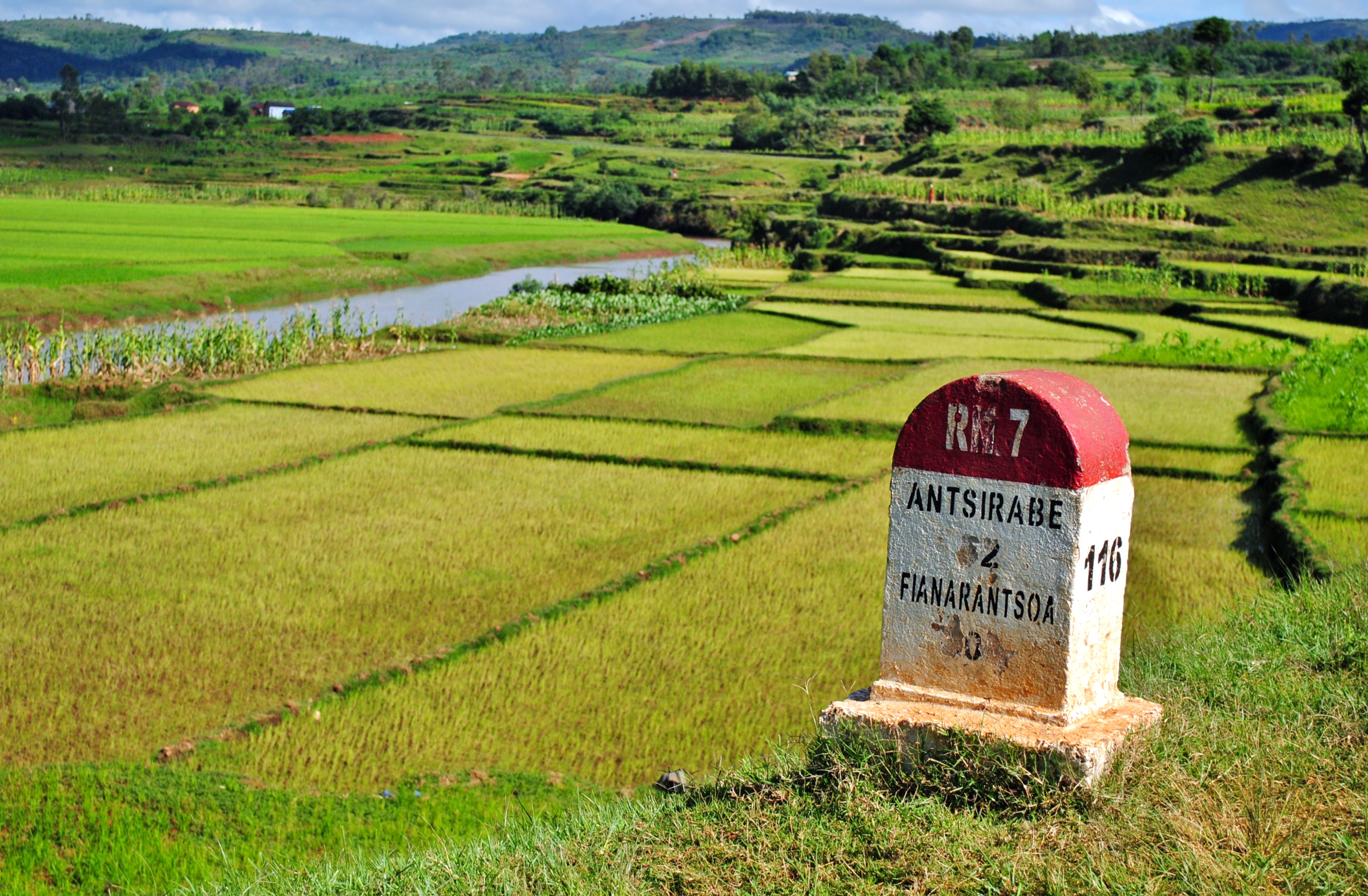
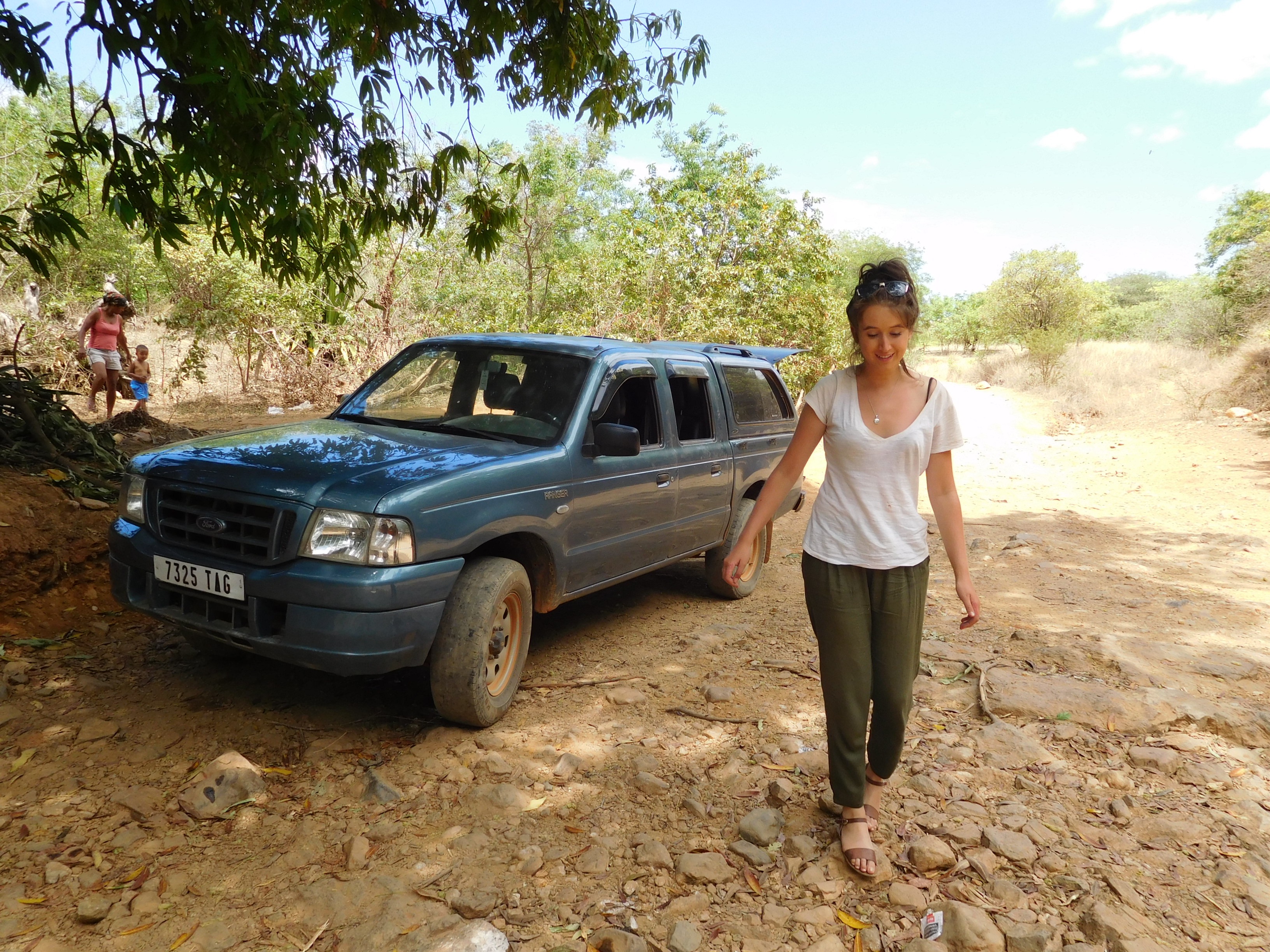
Getting There: To get to the Tsingy you must hire a private 4×4 from Morondava. The drive takes about 10 hours (about 200km through some rough roads), including a lunch stop at Belo-sur-Tsiribihina. Make sure you check out the vehicle before paying the driver… I had a great vehicle and driver on the way over but had to swap in Morondava and got stuck with a run-down old thing that barely made the journey back…
Costs: The journey cost me 200,000 aryairy per day (about $88AUD per day). This included the driver, car and fuel – you will also need to pay for the ferry crossings (30,000 aryairy each way), hotels in the area (I paid 40,000 aryairy per night), food, and, of course the park fee (I paid 135 aryairy for the Broadway hike – the longest and most expensive option that includes your guide for the day). Budget for about $400-$500 AUD for 3 days. If you are luckier than me and can find other people to split costs with it will end up being much more economical.